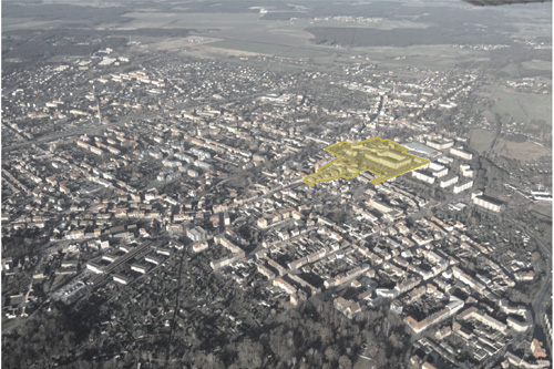
E8: Sites
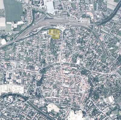
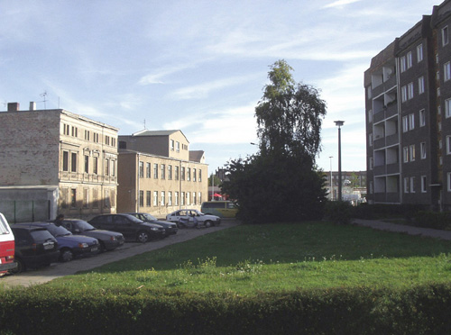
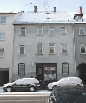
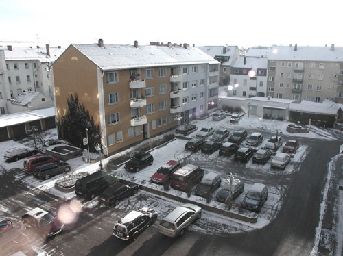
E8: Erfurt
Location brief description
Population: 198,181 Erfurt / 10,000 Ilversgehofen
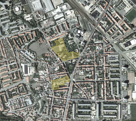
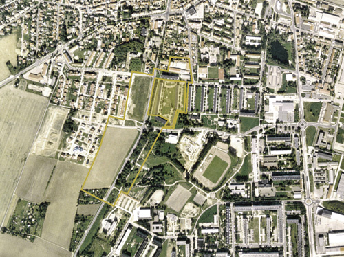
Considered area: 40 ha
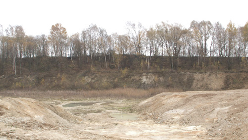
Competition area: Mittelhäuser Strasse approx. 5.6 ha / 2.4 ha; Salpeterberg approx. 2.5 ha / 1.1 ha
Agglomeration
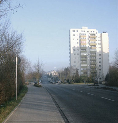
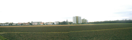
Erfurt is the seat of government and the most important center of Thuringia. Today, Erfurt can look back on more than 1260 years of eventful history, making it one of the oldest cities in Germany. Many distinctive features characterize the largest Thuringian city with its landmark cathedral and Severi Church as well as an almost completely preserved medieval city center. The observation area in llversgehofen, a district that grew out of a historical village, forms the northern end of the compact, urban city in transition to extensive industrial areas and large housing estates.
Topic
The urban shrinkage process that has already occurred in the district of llversgehofen requires a coherent relationship between the built environment and open space in order to achieve a qualitative renewal. The planning discussion is to show the development possibilities of the location and to contribute to consolidate the northern edge of the coherent, Wilhelminian development within the urban fabric. In order to achieve "more city" for fewer residents, medium- to long-term development perspectives and a visionary model are needed that links the urban core with the green open spaces and the urban infrastructure facilities.
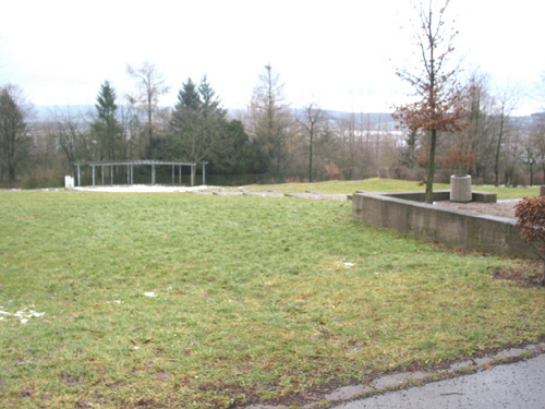
Location
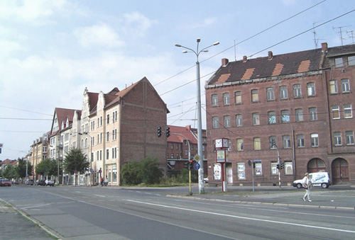
The area under consideration has structural and design deficits that reinforce each other. Due to the interplay of a poor image with real location problems, the entire area at the terminus of Magdeburger Allee is negatively characterized. The two competition areas are characterized by their good urban integration and proximity to the city center with very good public transport connections. The relative proximity to the housing estates of the 1960s to 1980s and the existing children's and youth facilities of supra-local importance contribute to the long-term development of the area into a lively and sustainable inner-city neighborhood.
Program
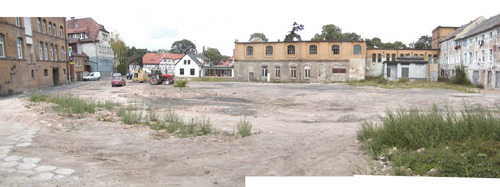
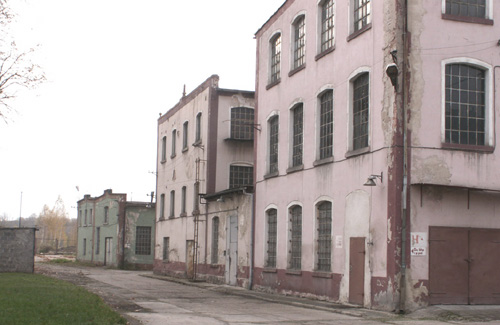
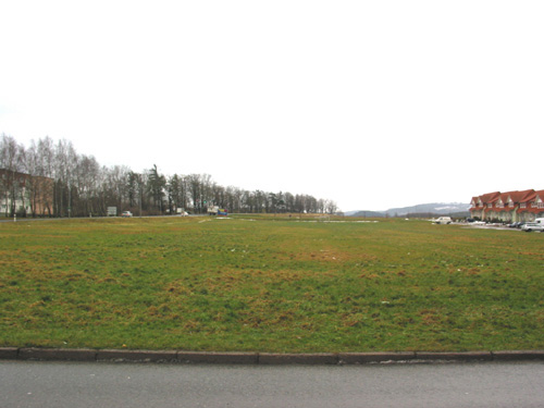
The "Mittelhäuser Strasse" area, which covers approx. 5 hectares, has a differentiated urban structure with a large number of different owners and uses. The brownfield site is characterized by the malting plant to the east. The area has high open space qualities and allows the development of different structures. The approx. 2-hectare "Salpeterberg" site is bordered to the west by quiet, small-scale structures and offers potential for various low-story residential forms. In view of the oversupply of multi-storey residential buildings, economically viable models must be developed to create a desirable spatial setting in relation to the busy Ilversgehofener Platz.
Objective
In the search for future-oriented urban concepts, the competition aims to develop alternative urban planning models for Erfurt-Ilversgehofen. The search for concepts is intended to help determine the opportunities for further urban development without growth. Private initiatives will be given a central role in this process. The definition of strategic approaches as well as medium- and long-term focal points for action should lead to the ability to "rethink Erfurt-Ilversgehofen".
Social/functional objectives
A new objective for the brownfields supports and strengthens the surrounding neighborhoods in the transformation process. In part, the areas are suitable for ownership formation for emerging households, also due to the moderate land prices. In addition to the overplanning of the specific subareas, special emphasis is placed on interlocking the areas and linking the surrounding uses.
Perceptive aspects
The areas have large natural open space potentials and very different urban structures, which offer the opportunity to build on existing structures and develop a neighborhood with its own qualities, paying particular attention to the interconnection of green zones and integration into the city's green system.
Goals of sustainable development
In view of the high oversupply in multi-story residential construction, a model for transformation is necessary for sustainable development, also for the city as a whole, which can also cope with a further decline in the number of inhabitants in the district and thereby lead to stabilization at a new level. The development of the areas makes use of the existing social and technical infrastructure and thus counteracts the urban and overall loss of substance.
E8: Gersthofen
Location brief description
Population: 21,200
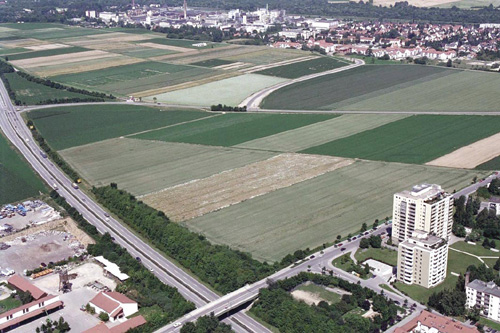
Considered area: 17.85 ha
Competitive area: to be defined by the participants
Agglomeration
Over the past 100 years, Gersthofen has developed from a farming village into a Swabian medium-sized center that owes its rapid growth to its convenient location, which it once enjoyed even in Roman times. Gersthofen is located about seven kilometers north of the city of Augsburg, directly on the Lech River. The federal highway 2, the "Roman Road", runs through the middle of the town. Gersthofen is connected to the A8 Munich-Stuttgart freeway by a newly designed freeway junction to the south of the town. The small town of Gersthofen is an up-and-coming business location with more than 2,000 commercial enterprises and a residential area with high recreational value and excellent quality of life.
Subject
The competition area offers one of the last major potential sites for urban expansion and has been earmarked for development for years. The area is shown in the land use plan as a residential area. Planning access to the last development area must necessarily include a comprehensive view of the entire urban area of Gersthofen. The goal is the harmonious further development of the existing settlement structures. In doing so, it is necessary to define existing deficits, to work them up and to find a solution. Concepts are sought that allow for development in phases over time, take into account the limiting factors of the competition area, and deal with the theme of the limited city, a city that is reaching its limits.
Location
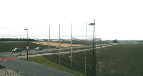
The area, which is currently still used for agriculture, is located northwest of the center of Gersthofen. To the northeast of the competition area, a residential area with areas for high-quality terraced housing, multi-storey housing, schools and a kindergarten is being planned. To the east of the area to be planned, there is a cemetery with an extension area. In the course of the competition, ideas and concepts can be developed that also refer to these areas. A residential area adjoins to the south, which has differentiated development structures, from detached single-family houses to row houses to multi-story point houses. The planning area is characterized by the highly congested route of the federal highway 2 in the west with a grade-separated connecting structure in the north.
Program
A sensible concept for the further development and supplementation of existing structures is to be developed for the area. Due to the active settlement of companies from the high-tech sector, the demand for residential space with an upscale standard is beginning to increase. However, there should be no one-sided development, but rather an adapted mix of housing types that takes into account current and future demographic developments. Keywords here are individualized type houses and a highly segmented housing market. The new structure and differentiation of the area is of great importance. In the planning, attention should also be paid to linking the area with the city center and the train station area with its upstream retail facilities. This could also strengthen the railroad stop, against the background of a planned rapid transit line. In addition to the urban integration of the competition area, a link should also be established with nature and the river Lech to the east of the area as well as the landscape area to the west.
Objective
Social/functional objective
The city of Gersthofen is reaching its limits with its development, therefore the handling of the existing land resources and the development of a new structure and identity is the most important part of the task. Special emphasis is to be placed on an optimal integration of the new quarter with the existing structures and boundary conditions.
Perceptive aspects
The area borders in the west directly on the federal highway 2, a traffic artery running in north-south direction with an increasing load of car and truck traffic. Structural, architectural and/or landscape planning solutions are sought here.
Aims of a sustainable development
The goal is to create an urban structure that allows the area to develop over a long period of time. Flexible building and housing forms are to be proposed, which also take into account the future demographic developments of society. New innovative concepts are sought that take into account ecological, social and economic aspects. In addition, the focus will be on dealing with barriers or boundaries in the settlement structure.
E8: Halle
Location brief description
Population: 240,000
Area under consideration: 18.4 ha
Competition area: to be defined by the participants
Agglomeration
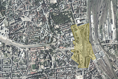
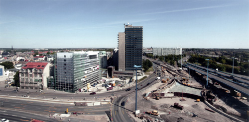
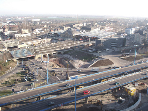
The city of Halle, the largest city in Saxony-Anhalt, is located on the banks of the river Saale and has very good transport connections through the Leipzig-Halle airport, the freeway intersection (A9, A14), InterCity connection and the Saale port Trotha. Together with Leipzig, 38 km away, Halle forms the center of a large urban economic area with service companies, technology centers and numerous scientific, university and IT facilities. The competition area is located at the eastern edge of the city center between the main train station and the pedestrian zone Leipziger Straße. Due to this location, it represents the most important gateway to the city center. The distance along the pedestrian zone to the market place in the old town is approx. 1000 m. At the same time, Riebeckplatz is a central junction and transfer point for various types of traffic in the city.
Topic
The thematic focus is the elaboration of a model for the development and design of the area between the city center and the main train station. The dominant element of the area is the traffic facility Riebeckplatz, a multi-lane traffic circle of the 1960s spanned by an elevated road. Currently, the traffic facility is being extensively reconstructed and optimized until 2006. The usage structure of the square ensemble with the multi-storey building complexes is in a process of disintegration, which is expressed by vacancies and demolition applications. The square is in danger of being reduced to its purely traffic-related function. The aim is to develop ideas on how this busy square can be integrated into an urban and landscape planning concept that at the same time opens up opportunities to establish new uses in the long term.
Location
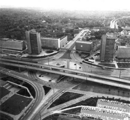
The current appearance of the entire site is shaped by the extensive redesign of the square between 1964 and 1970. At that time, the first elevated road in the GDR was built to accommodate traffic in the north-south direction; the east-west route was carried out in a traffic circle under the elevated road; pedestrians crossed under the traffic circle in a tunnel. The "Thälmannplatz" at that time was an expression of a new, socialist urban planning thinking and is to be seen in the context of other large redesigns such as Berlin Alexanderplatz, Chemnitz, Straße der Nationen etc.. Accordingly, the overall urban architectural design of the square goes far beyond its purely traffic-related function. The overall complex includes multi-storey high-rise buildings, which dominate as edges of the square, as well as two 22-storey residential towers, which accentuate the gateway to the city.
Program
The urban environment of Riebeckplatz is to be upgraded and redeveloped in order to create a new identity for the entire Riebeckplatz complex and thus a new image for the external presentation of the city. The streets running radially to the square essentially result in four large, urbanistically and functionally different fields, which are to be included in an overall concept and redefined. An urban planning and functional model can be developed for each field individually, but also for all four fields as a whole. Objectives for functions, uses and urban structure are to be developed and traffic connections between the fields and the square are to be analyzed. The 1960s buildings that characterize the square are to be discussed in terms of their significance for urban development. Some of the buildings belonging to the square have been renovated, some are empty and are to be demolished. The urban significance of the two vacant 22-story residential towers should be reviewed. The functions of bus station, streetcar connection, hotel and administrative location currently represent development potential.
Objective
The objective of the competition is to give the urban environment of the square a new image on the basis of the reconstruction and thus to strengthen its significance as an important gateway to the city. In particular, this raises the question of the possible functions of the different four fields in this area, which is strongly affected by traffic roads. In this context, different basic attitudes can be developed as objectives. For example, the development as a location for large-scale retail "green meadow", or further development of the existing green references "extension of the city park to the north", or new development of the hitherto characteristic use "four different fields".
Social/functional objective
Redefinition of the above-mentioned four fields of Riebeckplatz in terms of urban planning on the basis of the current redesign (development of a mission statement).
Perceptive aspects
The heavy traffic load means that only a few uses seem appropriate in this space, which is significant for the appearance of the city of Halle.
Goals of sustainable development
Strategies are being sought as to how, in times of lack of investment pressure, an urban planning concept can be developed that is capable of responding to changing conditions in the long term.
E8: Hamburg
Location brief description
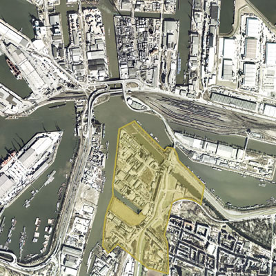
Population: 1,730,000 (Hamburg) / 48,000 (Wilhelmsburg)
Area under consideration: 35.5 ha
Competition area: to be defined by the participants
Agglomeration
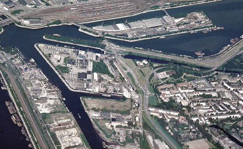
The Hanseatic City of Hamburg is located in the north of Germany and is the center of a metropolitan region of 4 million people as well as the engine of development in the region. Wilhelmsburg, located between Hamburg's inner city and southern Harburg on the so-called "Elbe Island", used to serve mainly agricultural purposes. Industrialization began with the establishment of the free port in 1888. Small and large commercial and industrial enterprises sprang up and, in parallel, workplace-oriented multi-storey housing in the west and owner-occupied housing estates in the east. Due to its historical development, the district still has heterogeneous structures today: Residential, allotment and green areas lie between intensively used, but also fallow commercial areas, and the center is characterized by major traffic routes.
Topic
Wilhelmsburg is a shrinking district in the growing city of Hamburg. The goal is to create connections between the district, which is spatially isolated due to its island location, and the city as a whole through urban development interventions. Strategies are sought on how to initiate a restructuring process, how to develop already available areas - in neighborhood to still existing commercial and industrial enterprises - in a meaningful way. The task is to develop ideas on how the area can be redefined in the long term and how the adjacent urban district can be upgraded through supplementary offerings.
Location
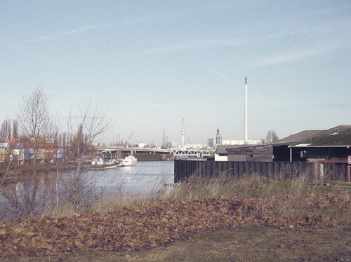
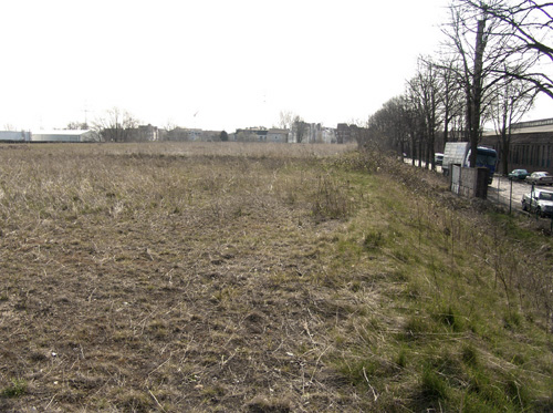
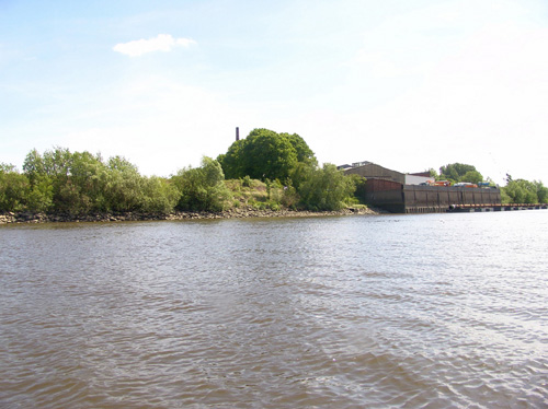
The competition area is located at the northeastern tip of the Wilhelmsburg district, with a view of Hamburg's old town. The area is the prelude to an industrially used strip along Reiherstieg, which is to be occupied by new uses in the medium term. The port use adjacent to the west of Reiherstieg will be retained in the long term, while residential neighborhoods adjoin it to the east, beyond the higher access road, the Reiherstieg main dike. The area is characterized by increasingly fallow land, a lack of reference to the waterfront, and a strong separation from the residential areas.
Program
The task is to reorganize a settlement structure that has been shaped by the port for decades and to open it up for future-oriented development. New uses and structures are sought that make the transitional area between the harbor use to the west of Reiherstieg and the adjacent residential use to the east attractive for future innovative working environments. The natural qualities of the river island and its favorable waterfront location are to be strengthened. On an industrial wasteland, a "lighthouse project" is to be proposed for the International Building Exhibition 2013.
Objective
Social/functional objective
The brownfield sites along Reiherstieg offer great potential for the establishment of future-oriented service and commercial enterprises in conjunction with recreational use for the district. Existing qualities are to be taken up, barriers overcome and new settlement structures developed.
Perceptive aspects
The neighborhood has social problems, particularly in the areas characterized by publicly subsidized housing, due to the high proportion of unemployed and foreign residents resulting from the structural changes in the economy. The long-term goal is to attract stabilizing population groups through attractive employment and recreational opportunities and to counteract the loss of image of the urban neighborhood.
Sustainable development goals
The open space references and the experienceability or accessibility of the waterfront edges are to be improved and linked to the urban environment. The focus is on upgrading the east-west connection from Reiherstieg to the Wilhelmsburg center. The major projects associated with the "Sprung über die Elbe" flagship project, the International Building Exhibition and the International Garden Show 2013, as well as urban development funding procedures and EU measures already underway, will make an important contribution to upgrading the area.
E8: Kleines Dreieck
Location brief description
Population: 26,800 (Bogatynia) / 7,300 (Hrádek n.N) / 26,224 (Zittau)
Competitive area: approx. 3.0 ha (Bogatynia) / approx. 7.2 ha (Hrádek n.N) / 0.6/1.9 ha (Zittau)
Agglomeration
The "Little Triangle" is the name given to the group of towns of Zittau in the southeast of the Free State of Saxony (D), Hradek nad Nisou in the north of the Liberec Region (CZ) and Bogatynia in the southwest corner of the Dolnoslaskie Voivodeship (PL), which has been developing intensively since 2001. This group of cities, the core of the Euroregion "Neisse", is home to about 61,000 inhabitants of different nationalities. The three core cities to be included in the competition are extremely differentiated in terms of urban development. While Zittau has a listed historic city center and Hrádek can be considered a typical example of a small Bohemian town, Bogatynia alternates village and industrial structures. Mentalities, points of view and perceptions from Poland, the Czech Republic and Germany will never be completely the same, but since the EU's eastward enlargement they can be brought together by means of concrete projects.
Topic
The cities moved from their structural peripheral position into the center of the enlarged Europe. Thus, development opportunities are emerging from previous locational disadvantages. As a result of the development processes that are actually taking place, it is therefore no longer sufficient to consider local problem areas in isolation. Instead, the focus must be on new cross-border needs. Scenarios must be developed for the region, which is characterized by shrinkage and growth. These scenarios must be supported by sustainable development structures and concepts that can be implemented.
Location
Zittau
As a medium-sized center, Zittau is increasingly gaining cross-border significance. The city has a dense and networked scientific environment with close contacts to the economy as well as innovative companies. This position should be further strengthened. Declining birth rates and migration with stabilization tendencies have led to high housing vacancy rates in the city, even in the refurbished stock. The competition area in Zittau, the site of the former Robur works, is located on the northern edge of the historic old town in the immediate vicinity of the train station.
Hrádek nad Nisou The town of Hrádek represents a so-called focus municipality on the Czech side, with Lake Kristyna as a leisure and recreation area and with existing service facilities taking on complementary functions. The town has seen a slight increase in population, especially due to an influx from the district capital Liberec. The competition area in Hrádek, the site of a former brickyard, is located beyond the city center on the other side of the railroad line, in the immediate vicinity of the railroad station.
Bogatynia
The municipality of Bogatynia includes another 16 districts in addition to the town, but lacks a distinct town center. Bogatynia complements the centers of Zgorzelec and Jelena Góra. The economic power of the town is determined by open-cast mining and power plant. There is a need for housing, as many buildings are still unrenovated and traditional family structures are dissolving. The competition area in Bogatynia, the site of a textile factory that is largely no longer in use, borders directly on the future town center.
Program
Based on the regional development concept, a vision for the region is to be developed that creates an image of the Tricity as an innovative region in Europe and as a future common economic and living space. On the urban level, it is to be investigated how inner-city brownfield sites are to be dealt with in a demand-oriented settlement area development. Development potentials and competencies are to be combined into a common added value, competitions are to be largely excluded and a growing together as a tri-city is to be promoted. Based on this, development proposals are to be submitted for all three areas close to the city center.
Objective
Three levels are to be considered for the development of the overall concept.
Level 1 - Region
The entire area of the "Little Triangle" is to be considered. The proposed visions are to give the region its own distinctive image for the future and to show potential for growing together as a tri-city.
Level 2 - Urban structures
Functional settlement structures are to be developed for the urbanized areas in the long term. It must be shown where the settlement body can tolerate shrinkage and where growth should effectively shape the Tri-City. Priority is to be given to developing a chronological sequence of changes to areas that serve residential and work purposes.
Level 3 - Competitive sites
For one of the three sites, the results of the preceding considerations are to be elaborated in concrete terms in a design of building masses and open spaces. The aim is to develop a future-oriented image with a view to revitalizing the city center. Interdisciplinary cooperation is recommended when working on the task.
E8: Leinefelde-Worbis
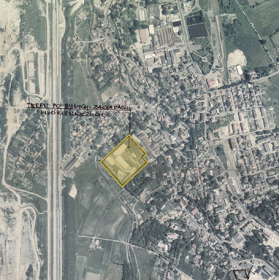
Site brief description
Population: 21,421
Consideration area: 27.0 ha
Competition area: 10.8 ha
Agglomeration
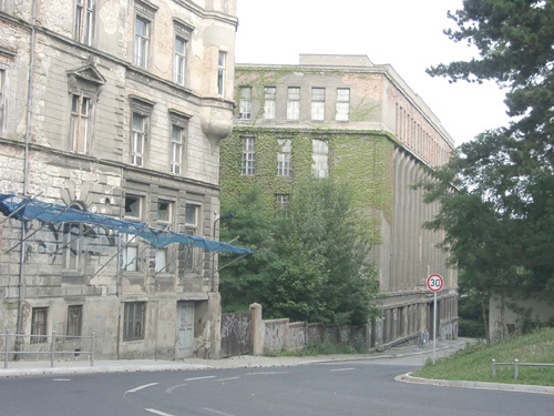
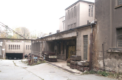
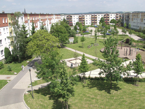
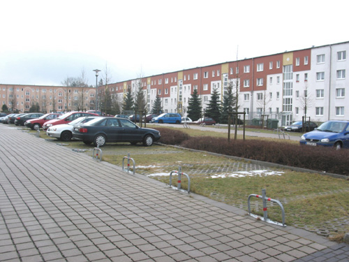
The city of Leinefelde is located on the northwestern edge of Thuringia, in the Eichsfeld region. The city is a particularly typical example of the industrial cities that were "artificially" and, as it were, "over night" built out of the ground during socialism. In a former village with about 2,250 inhabitants, a cotton spinning mill with about 4,500 employees has been built since the 1960s as part of the so-called Eichsfeld Plan, and in neighboring Deuna a cement plant with over 2,000 jobs. For these workers, a large residential area in prefabricated slab construction was built in the south of the former village. A town with over 16,000 inhabitants was created, 90% of whom lived in the Südstadt prefabricated housing estate. With the fall of the Berlin Wall, serious social and economic changes took place, which affected the industrial location of Leinefelde in a very special way due to unemployment and loss of inhabitants. The city has consistently initiated the necessary transformation process and is implementing it at a high qualitative level. The results achieved in the meantime are internationally exemplary.
Topic
The urban redevelopment process has concentrated on stabilizing the core area of Südstadt and shifting the housing surpluses to the outlying areas in order to create the conditions here for far-reaching restructuring and large-scale demolition. The first development stages of the new housing area close to the city center had been modernized at an early stage and could be considered stable for a long time. However, it has become apparent that the housing today no longer meets the standards that have since been achieved in Leinefelde and that the urban development structures at the interface between the old town and the new housing development impede the functional and structural integration between these subareas. The task is to strengthen the interlinking functions and to design high-quality housing.
Location
The area under consideration is the interface between the former village and the southern part of the city. These very different urban structures meet at Konrad-Martin-Strasse, which runs in an east-west direction, and confront each other abruptly. The contrast is also intensified by embedded, relatively large school areas as well as the road construction office; these areas must be included in the consideration as well as the still available building areas, which are to be activated after the downgrading of Mühlhäuser Straße from a federal to a local road. Since Konrad-Martin-Strasse is not connected to Mühlhäuser Strasse, it cannot perform important linking functions. Thus, the area under consideration presents itself as rather remote and impermeable in the inner-city road network and is characterized by functional and structural breaks.
Program
Ten years after their first refurbishment, the rows of prefabricated apartments on Konrad-Martin-Strasse show conceptual and qualitative deficits that call into question their long-term rentability; this is all the more problematic because the generation change of first-time tenants is now imminent in this area, so that an above-average number of new tenants will have to be recruited for this area in the next few years. It must be assumed that some of the apartments here will also have to be demolished. The owners of the rows on Konrad-Martin-Strasse need new structural and urban development perspectives for the sustainable development of their stock as part of urban redevelopment. In this context, the key position of these properties between the town center and the southern part of the town is to be valued as an important location factor. This means that the functionality of this interface in terms of connection and mediation between these contrasting structural areas must be improved. Suitable concepts are to be developed for this purpose.
Objective
Social/functional objective
The competition area is to be developed in such a way that in the long term it meets the requirements for contemporary living in an attractive and lively micro-location. In particular, the target group of young families with children is to be addressed.
Perceptive aspects
In accordance with Leinefeld's urban redevelopment philosophy, the interface between the town center and the southern part of the town is to be thematized and staged in such a way that, in the continuity of development, a special neighborhood emerges that experiences and achieves positive impulses from its location in this spatial and historical area of tension.
Goals of a sustainable development
Cautious but effective adaptation of the housing stock to changing requirements has become the central theme of urban redevelopment in Leinefelde, and high functional and design quality is regarded as a basic prerequisite for sustainability. This requirement is also to be met by the interface between the old town and the southern part of the city.
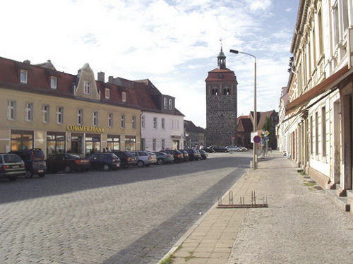
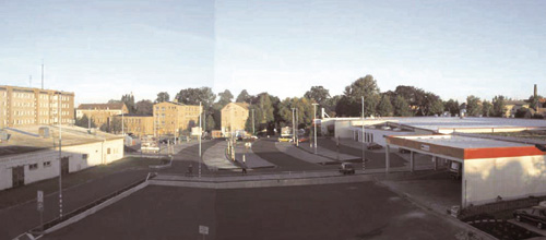
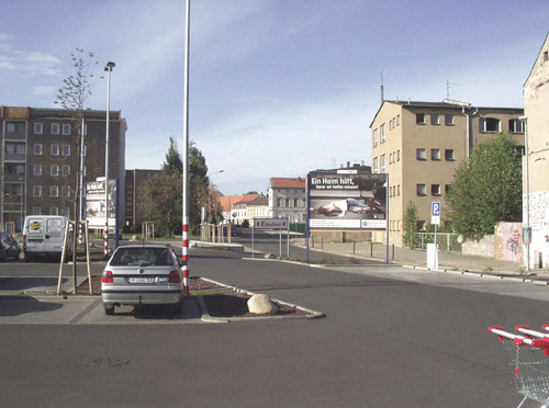
E8: Luckenwalde
Location brief description
Population: 21,702
Area under consideration: 4.9 ha
Competition area: 1.9 ha
Agglomeration
Luckenwalde is the district capital of the Teltow-Fläming district in Brandenburg, about 60 km south of Berlin. The city of Luckenwalde is well connected to the metropolis by rail and B101. The city is trying to counteract the migration tendencies caused by the collapse of the industrial base after reunification by profiling itself as an attractive residential location with special qualities in the areas of leisure, sports and nature. An essential aspect of this is to strengthen the attractiveness and functional diversity of the urban core.
Topic
The task is to strengthen the inner-city functions of the city center by means of urban development measures that help to establish a spatial-functional connection to the neighboring retail location Einkaufspark Burg. The aim is to mediate between the historic city center with pedestrian zone and the new retail focus "Einkaufspark Burg", which is subject to further settlement pressure.
Location
The area under consideration connects the historical origin of Luckenwalde, the site of the castle demolished in 1285, with the current city center, the market with St. John's Church, market tower and city hall and the pedestrian zone Breite Straße. Between the urbanistically defined area of Markt / Breite Straße and the Burg shopping park, which is attractive as a retail location, there is a clear caesura, which is characterized by a busy thoroughfare, the adjacent areas of a large housing estate, vacant, partly ruinous building fabric, cleared plots of land and an open space design conceived as a residential environment greening.
Program
Core area: Setting and reorganization of the Markt-Burg streetscape through development and use proposals for the properties Markt 22 and 33, Burg 29 to 31, as well as through landscape architectural, artistic and traffic design. Connection of the Nuthegrünzug to the Burg shopping park. Resolution of the conflict of objectives: expansion of the Burg shopping park versus strengthening the pedestrian zone. Extended area of consideration: development / use of the properties Breite Straße 52/53, Baruther Straße 21, development ideas for the large housing estate buildings including open space design and proposals for the routing of the Nuthegrünzug in the area of Mühlenstraße / Trebbiner Straße.
Objective
Social/functional objective
The objective is to mediate between the historic city center and the newly settled "Burg Shopping Park" and to strengthen the attractiveness and the variety of offers of the city center as a whole by upgrading the cityscape and the public space as well as by additional functions.
Perceptive aspects
In addition to the structural measures, the continuation of the Nuthe greenway, which has been completed in the southern area or is in the planning stage, via Beelitzer Strasse to the north is of particular importance. The design and linking of the "Burg Shopping Park" with the planned Nuthe green corridor is an essential aspect of the task.
Goals of a sustainable development
The strengthening of the supply function aimed at with the "Burg Boulevard" contributes to the improvement of the quality of living and is an important building block for the development of Luckenwalde as an attractive residential location on the edge of the Berlin metropolis.
E8: Neu-Ulm
Location brief description
Population: 50,150
Consideration area: eastern city center
Competition area: to be defined by the participants
Agglomeration
Together with the city of Ulm, the large district city of Neu-Ulm forms a regional center with a total population of around 180,000. The city of Neu-Ulm consists of a total of nine districts and is an economically successful city with a university of applied sciences and also an important industrial and logistics location in a very scenic location in the Danube valley. Well connected in terms of transportation, the city has initiated significant developments with the projects of the century such as NU21 (lowering of the railroad tracks), the new district of Wiley and the State Garden Show 2008. Downtown Neu-Ulm has great development potential in close proximity to downtown Ulm and its location directly on the Danube.
Topic
The task is the renewal of an inner city area characterized by the reconstruction of the 1950s into an attractive residential location. Through targeted interventions in the housing stock and reinterpretation of private and especially public open spaces, the eastern inner city is to be upgraded and made accessible to new user groups. Due to the largely unmodernized housing stock, the eastern inner city today attracts socially weak tenants (people with a migration background, recipients of transfer income, etc.); residents who could stabilize the district are leaving it. All in all, it is about an old but also extremely current task of urban development, namely how to initiate change in the face of declining population figures and dwindling resources, and how to renew a district with targeted but cautious interventions.
Location
The city of Neu-Ulm was founded in the mid-19th century as a fortress and garrison town. The inner city layout is still dominated by a clear block structure. Due to heavy war damage, the existing development is mainly composed of post-war buildings from the 1950s and 1960s. The location is well connected to the utilities of Neu-Ulm as well as to downtown Ulm. The spatial proximity to cultural institutions, the landscape relation to the Danube in the north and with the lowering of the railroad in the south to the Glacis (park in the former fortress belt) offer manifold potentials for future development.
Program
Maximilianstrasse with its branches and the forecourt to the central school are to be redefined. Through design measures, differentiation and networking, they are to gain a special attractiveness as places with a high quality of stay for different groups of residents. The so-called Green Bridge, which connects the various areas of the State Garden Show as a north-south axis, leads across Maximilianstrasse and is an essential component of the competition. Through further construction measures in buildings owned by NUWOG and the city, a visibly denser network of redeveloped street spaces and a patchwork of modernized residential buildings is to be created in continuation of projects already implemented, also to encourage private individuals to take their own measures. The challenge is to transform existing buildings and public spaces in such a way that an upgrading process is initiated in the district.
Objective
Social/functional objective
The objectives are the differentiation of housing offers accompanied by the improvement of standards in order to attract new tenant groups; this also includes the development of cost-effective, exemplary models of barrier-free and energy-efficient modernization, even with a high level of intervention. Fundamental innovative approaches are expected as to how modernization measures can be carried out in the area of conflict between still justifiable economic efficiency and the abandonment of traditional solution approaches. The measures should enable diversification in the resident population and create attractive urban spaces with a high quality of stay.
Perceptive aspects
The potentials in the district as well as the economically, culturally and scenically attractive offers in the surrounding area are to be valorized by spatial and functional linking. The reorganization of the flowing and stationary traffic as well as design measures in the public space are essential aspects to increase the quality of stay and to strengthen references to the surrounding attractions. The area is to be integrated into the city's system of public spaces.
Goals of sustainable development
The integrative treatment of urban, open space and building planning aspects should ensure a structure that is effective and interpretable in the long term and generate urban qualities. The population is to be retained in the city center and new residents are to be attracted in order to counteract the negative demographic development (shrinkage).